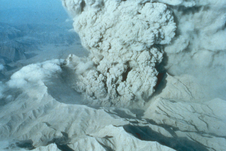
Cataclysmic volcanic eruption in Philippines hid fact sea level rise is well and truly upon us
Pinatubo eruption cooled down planet, hiding effects of global warming on ocean rise.

Sea levels are rising due to global warming, but the extent of this phenomenon has so far been attenuated by the massive 1991 eruption of Mount Pinatubo in the Philippines, scientists have said. This natural catastrophe temporarily cooled down the planet, hiding the effects of increased greenhouse gases in the atmosphere.
In the past decades, many studies have investigated the link between a warmer climate and ocean rise, showing that higher temperatures caused water to expand and melted glaciers and ice sheets, thereby increasing the volume of water in the sea.
From 1993, these changes in sea levels started to be recorded by satellite observations, providing scientists with new tools to confirm the impact of global warming on oceans.
But unlike what most studies predicted, satellite data did not reveal an important sea rise. In fact, the scientists discovered that the rate of sea level rise held fairly steady at about 3 millimetres per year, during the past two decades.
However, a recent study published in Scientific Reports, now points out that satellite records started very soon after the Pinatubo eruption, meaning the data on global sea level rise is potentially distorted. Indeed, the eruption had a cooling effect, because of the sunlight-blocking volcanic aerosols that were emitted - so the real impact of rising temperatures on ocean levels may have so far been concealed.

"When we used climate model runs designed to remove the effect of the Pinatubo eruption, we saw the rate of sea level rise accelerating in our simulations," says lead author John Fasullo. "Now that the impacts of Pinatubo have faded, this acceleration should become evident in the satellite measurements in the coming decade, barring another major volcanic eruption."
A world without eruption
The scientists decided to model how the world was before the dramatic eruption in the Philippines and how fast sea level rise was accelerating. Before the use of satellites, sea level was mainly measured using tide gauges. While records from some gauges stretch back to the 18th century, variations in measurement technique and location mean that the pre-satellite record can only provide an estimate of global mean ocean level.
To avoid using this incomplete data, the researchers decided to create and compare forty different simulations models of sea level rise before and after Pinatubo, taking into account the variability of different natural factors affecting sea level. Other models omitting the impact of volcanic aerosols were created, to represent a world in which the volcanic eruption had no impact.

The simulations indicate that the Pinatubo's eruption caused the oceans to cool and sea levels to drop by about 6 millimetres immediately before the first satellite records. The models also suggest that if the Pinatubo eruption had not occurred - leaving sea level at a higher starting point in the early 1990s - the satellite record would have shown a clear acceleration.
"The scientists have disentangled the major role played by the 1991 volcanic eruption of Mt. Pinatubo on trends in global mean sea level," concludes Anjuli Bamzai, program director in the National Science Foundation's Division of Atmospheric and Geospace Sciences, which funded the research. "This research is vital as society prepares for the potential effects of climate change."
© Copyright IBTimes 2025. All rights reserved.


