What is 'Super El Niño', And Who Could It Affect? Scientists Weigh In On The Rare Phenomenon
Understanding the impacts and importance of monitoring El Niño

A potential 'Super El Niño' could signal a period of intense global weather changes, with widespread impacts that reach far beyond the Pacific. As climate forecasters monitor ocean temperatures, the possibility of a very strong El Niño is raising concerns about its effects on weather patterns worldwide.
Understanding El Niño and Its Cycle
El Niño is a natural climate pattern involving warmer-than-average sea water in the central and eastern tropical Pacific Ocean. This phenomenon has been recognised since the 1600s when South American fishermen noted unusually warm waters around Christmas. The cycle, known as El Niño – Southern Oscillation (ENSO), swings between warmer and cooler ocean conditions along the equator in the tropical Pacific.
When sea temperatures rise significantly above average, it can influence weather patterns globally. During La Niña, which is the opposite phase of the cycle, cooler-than-average waters dominate the Pacific, leading to different weather effects. For example, La Niña tends to bring increased dryness to parts of the southern United States and colder winters across the north, without impacting the planet's long-term warming trend.
What Defines a 'Super' El Niño?
The term 'Super El Niño' isn't an official classification by NOAA, but it's often used to describe periods when sea surface temperatures in the tropical Pacific are up to 2° Celsius (3.6° Fahrenheit) above average over several months. Past events, such as those in 1997–98 and 2015–16, fit this description.
Currently, there's about a 15% chance of experiencing a 'Super El Niño' by the end of the 2026 hurricane season, which concludes on the 30th of November. AccuWeather meteorologist Alex DaSilva explained, 'Right now, there's about a 15% chance of a Super El Niño by the end of this hurricane season, which we've only seen once since the year 2000.' However, scientists from NOAA remain cautious, noting that the outcome could range from neutral conditions to a very strong El Niño.
NOAA's recent report indicates a 61% probability that El Niño will develop between May and July 2026. The persistence of such conditions into the end of 2026 depends on various factors, including westerly wind patterns across the Pacific, which are still uncertain during upcoming summer months.
Impacts of a Strong El Niño
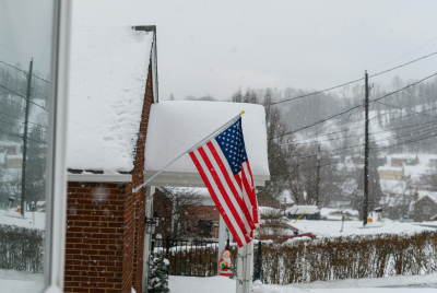
El Niño significantly influences weather patterns, especially during the colder months. During an El Niño winter, the southern United States often experiences wetter-than-normal conditions, while the north may see less precipitation. Scientists warn that a strong or 'super' El Niño could bring substantial storms to the West Coast and intensified weather systems along the East Coast, driven by warm, moist air from the Gulf and Atlantic.
In terms of hurricanes, El Niño tends to reduce activity in the Atlantic by 'increasing upper-level wind shear', which disrupts hurricane formation. Conversely, the eastern Pacific generally sees more hurricane activity during El Niño years, as warm waters fuel storm development. This pattern can alter the severity and frequency of storms in both regions, affecting millions of lives and economies.
Why Is It Important to Monitor El Niño?
The ENSO cycle is a key factor in winter weather forecasts because it influences temperature and precipitation patterns when temperatures drop. Although its impact on summer weather is less direct, understanding El Niño is crucial for sectors such as agriculture, water management, and disaster preparedness. The World Meteorological Organization emphasises that seasonal forecasts for El Niño and La Niña are vital tools for preventing economic losses and safeguarding communities.
Celeste Saulo, Secretary-General of the WMO, stated that these forecasts support humanitarian efforts and disaster risk reduction. They provide essential insights that help governments and organisations prepare for extreme weather events, potentially saving lives and reducing damage.
While a 'Super El Niño' remains a possibility, ongoing monitoring and research continue to shape expectations. Its real-world effects could impact weather globally, especially in North America, with wetter winters, storm activity, and changes in hurricane patterns. As scientists watch the Pacific Ocean's temperatures closely, the coming months will reveal how strong this cycle might become and what it will mean for the planet.
© Copyright IBTimes 2025. All rights reserved.
- Recommended For You