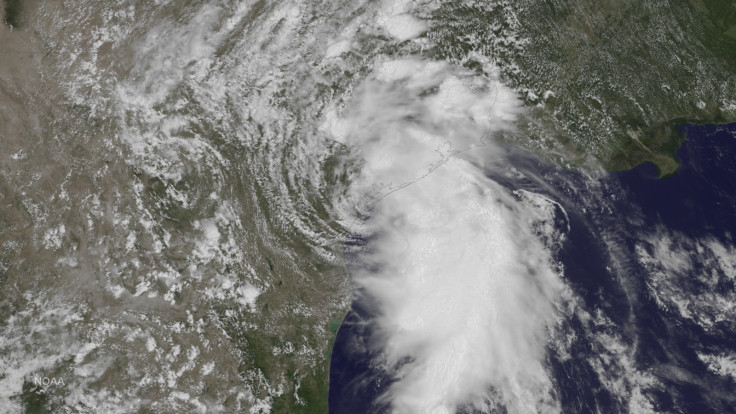
Tropical Storm Bill update: Storm expected to drop 12 inches of rain as it makes landfall in Texas

Tropical Storm Bill reached the Texas coast by noon local time on 16 June, dousing the state in more heavy rain and strong winds.
The National Weather Service announced the tropical storm made landfall south of Houston on Matagorda Island and is moving towards the west at about 9mph.
The weather service placed a tropical storm warning in effect for Baffin Bay to High Island. Eastern Texas is expected to receive between 4 to 8 inches of rain, with isolated maximum amounts of 12 inches. Eastern Oklahoma is expected to get 4 to 8 inches, while western Arkansas and southern Missouri are set to receive 2 to 4 inches.
The rain-soaked state is expected to experience some flooding near the coast, the weather service warned. If peak surge occurs at the time of high tide, upper Texas coast could see between 2 to 4 feet of flooding.The western Louisiana coast could also see between 1 and 2 feet of flooding.
Tropical Storm Bill is expected to continue moving west but will turn towards the west-northwest or northwest by tonight, the weather service stated. Maximum sustained winds were recorded by the Air Force Reserve at 60mph.
According to NPR, the state set the record for the wettest single month in May with a recorded 8.81 inches of rain. Marshall Sheperd, the director of atmospheric sciences at the University of Georgia, spoke to the Associated Press about the previous storm's influence on Tropical Storm Bill.
"While tropical storms usually gather power from the warm waters of the ocean and then weaken once they move over land, Nasa-funded research has shown some storms can actually strengthen over land by drawing from the evaporation of abundant soil moisture," he said.
The storm is expected to weaken into a tropical depression overnight, according to the weather service.
© Copyright IBTimes 2025. All rights reserved.


