Delving into drivers of deforestation: Map shows extent of loss in Borneo since 1970s
New study analyses four decades of satellite images – overturning assumptions about the role of industrial plantations in Borneo forest loss
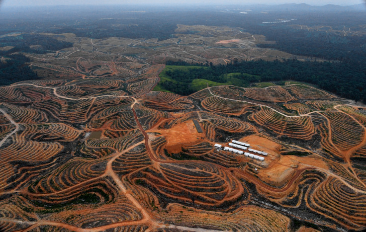
Debates over forest loss in Borneo generally focus on the extent to which industrial plantations are to blame: those on the conservation side charge oil palm and pulp and paper for the destruction of tropical rainforest, those on the plantation side tend to argue that planting is done on already deforested land.
Until now, both sides have lacked clear evidence to justify their claims.
"The story is complex, drivers of deforestation are many. Until now we lacked information to distinguish so-called good and bad plantations," said Douglas Sheil of the Norwegian University of Life Science.
In a new study published in Scientific Reports that he co-authored, Sheil and fellow scientists reviewed over 400 Landsat satellite images of Borneo between 1973 and 2015 to track forest loss and degradation and the concomitant expansion of plantations. The impacts of drought and fires tied to El Nino events were also considered.
According to the study, 76%, or 55.8 million hectares, of Borneo was old-growth rainforest in 1973. The scientists determined that approximately 18.7 million hectares of forest was cleared between 1973 and 2015, and that industrial plantations expanded by 9.1 million hectares.
By 2015, 50% of the island shared by Malaysia, Indonesia and Brunei remained forested, with 28% old-growth rainforest and 12% covered in industrial plantations. "We calculated the delays between deforestation and the establishment of industrial tree plantations. We reasoned that, as a statistical generalisation, industrial plantations developed rapidly after forest clearance are responsible for that clearance, while the longer the delay the more likely such plantings are avoiding direct deforestation," said Center for International Forestry Research (CIFOR) scientist and lead author of the study David Gaveau.
Making comparisons

The study found contrasting patterns between Indonesia and Malaysia's rate of conversion, i.e. the amount of time between deforestation and development. In Malaysia, rapid conversion to plantations has been greater, at 57-60% of all deforestation since 1973, while Indonesia's was at 15-16%.
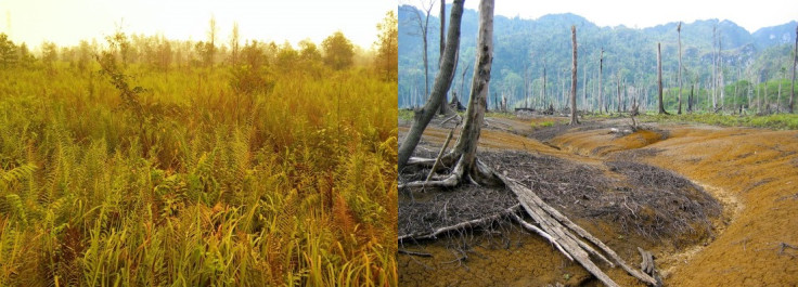
"Of the 15-16% of deforestation in Kalimantan associated with rapid conversion to industrial plantations, 11-13% is attributed to oil palm. What this shows is that the majority of oil palm plantations were developed on degraded lands, meaning forests converted to ferns, grasslands and scrubs by drought and recurrent burning, mainly during El Nino years," Gaveau said in a presentation at the 2016 Annual Meeting of the Association for Tropical Biology and Conservation.
That so many oil palm plantations in Kalimantan were developed on fire-induced deforested land offers much nuance in the debate over whether oil palm is the main driver of deforestation in the region.
"People have been arguing that plantations should be developed on degraded lands, and what we found – with caveats – is that in Kalimantan in Indonesia that is largely what has been happening," Sheil said. In Malaysia, on the other hand, the study suggests that the plantation industry was the principle driver of the loss of forest because of the speedy rate of conversion.

Seen from that perspective, Indonesia seems to have done much better than has been widely assumed. But, the scientists found something changed in 2005.
"Since 2005, Kalimantan experienced a boom in plantation development. Over half of the existing plantations were added since then, and there has been a steep increase in the rapid conversion of forests to plantations, Kalimantan becoming the principle contributor of rapid net forest conversion by area. Despite planting on degraded lands, deforestation remains very high in Indonesia and Malaysia, and does not appear to be slowing," Gaveau said.
"More needs to be done to protect Borneo's forests," he added.
Hot topic

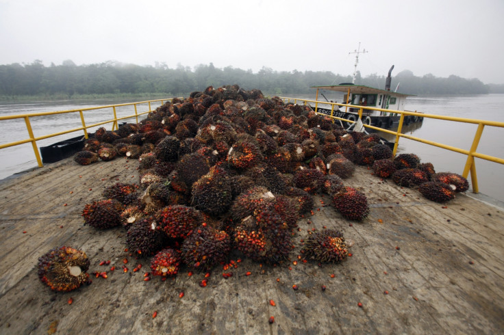
Underscoring the complexity of the deforestation process is essential, especially amid increasing calls for boycotts of palm oil products.
"Oil palm expansion has accelerated over time, and expands in different local contexts. As such, this expansion takes over different land uses ranging from forests, agroforestry systems and degraded lands. This study confirms these diverse land use dynamics linked to oil palm expansion," said Pablo Pacheco, principal scientist at CIFOR and co-author of the study.
It is no longer possible to generalize about oil palm trajectories and likely outcomes.
"Oil palm is not always a bad thing," Sheil said. "It generates a sizeable amount of revenue for people and is very efficient in generating incomes from limited land. I worry that we are stigmatising an entire crop – but it's not the crop that is the problem but where we grow it."
Study co-author Erik Meijaard of the Borneo Futures Project said facts such as those provided by the study are much needed in the debate over extractive industries."Oil palm is so polarized between camps that love it or hate it with a vengeance. There is much that has not been quantified with regard to oil palm development and causal relationships," he said.
The study highlights the key role of repeated forest and land fires in Borneo deforestation, and an important question that emerges is whether there is evidence of large-scale natural forest regeneration in those lands.
Another important aspect of land use dynamics linked to oil palm is regeneration of degraded lands. "So far, the limited studies out there point to weak regeneration of degraded lands. It might be preferable to designate degraded lands for agricultural purposes, except perhaps degraded peatlands, because they represent a major public health issue because of the toxic smoke they release when burning," Gaveau said.
With the Indonesian government's creation of the Peatland Restoration Agency in 2016, efforts to address the draining of peatlands and resulting fires are underway, as well as moves to find companies culpable for fires on their land.
Middle way

The maps of Borneo over the years that the study employs will soon be available online, and people will be able to track forest loss and conversion to plantations themselves. For Sheil, the transparency their work with maps encompasses is key to progress on the issue.
"There's a lot of promise in these open systems, in an online system that shows concessions and land-use history," he said. "The big surprise is that we found so much of the planting was on already deforested land. So we need to give companies credit for this without losing sight of how much forest has been lost."
According to Pacheco, more studies are needed in the hopes of improving conservation practices and economic opportunities.
"Additional analysis is required to look beyond industrial oil palm plantations and capture the dynamics of oil palm expansion in smallholder lands, and how other actors, including local investors, are shaping land use dynamics linked to oil palm expansion".
Meijaard said, "Our data clearly shows that oil palm and industrial plantations play a major role in deforestation, but that is not the whole story. We need to find a middle road to move ahead."
This article first appeared on the Center for International Forestry Research' blog. Read the original here.
© Copyright IBTimes 2025. All rights reserved.


