Super Typhoon Noru: This is what one of Earth's most powerful storm looks like from space
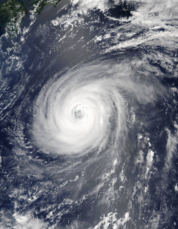
Nasa astronauts aboard the ISS captured pictures of Noru as it travelled across the Pacific Ocean.

One of the Earth's most powerful storms, typhoon Noru, is barrelling across the Pacific Ocean, taking aim at Japan and maybe even China and Korea. Noru was formed on 21 July and has since steadily gained intensity.
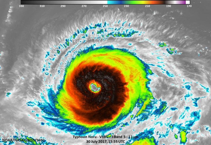
The typhoon was also spotted by astronauts aboard the ISS (International Space Station), who captured some incredible images while the ISS made its flyby over the storm. Noru is being tracked by Nasa satellites, too.
"Noru has been around for 13 days since it formed on July 21 about 230 miles nautical miles north-northeast of Minami Tori Shima. The storm moved to the southwest and once it moved southeast of Iwo To Island, Noru then turned to the northwest and is now west of the island," Nasa said in a statement. "The Joint Typhoon Warning Center expects the storm's intensity to fluctuate over the next 4 days, as it approaches southwestern Japan."
It escalated from a tropical storm to a category 5 super typhoon, with maximum sustained winds around 165 miles per hour. However, the typhoon has since weakened to a category 2, with sustained winds of around 100 miles per hour, Mashable reported.
Super Typhoon #Noru, amazing the size of this weather phenomenon, you can almost sense its power from 250 miles above. pic.twitter.com/x4R0FZSfRn
— Randy Bresnik (@AstroKomrade) August 1, 2017
According to the Weather Channel, the Japanese Coast has already been affected by Noru. The JMA (Japan Meteorological Agency) has also issued advisories for high waves in the Ryuku Islands. Alerts have also been issued out to the Pacific coasts of Kyushu, Shikoku and Honshu, to the east of Tokyo.
When Mother Nature gets to spinning, it can be an awesome but scary sight. Looks like super Typhoon #Noru is gaining momentum. #EarthShapes pic.twitter.com/hR8gyYlhEs
— Jack Fischer (@Astro2fish) August 1, 2017
Although weather forecasters suggest that Noru may weaken over the next couple of days, the storm is expected to undergo a strengthening phase during the weekend. However, Noru may lose some of its intensity after its northward bent, after some interaction with land. However, it is unclear how much of intensity Noru may still maintain.

© Copyright IBTimes 2025. All rights reserved.


